
Overall Run Falls Hike (Shenandoah National Park Trail Guide & Waterfall Photos)
Overall Run Falls is the tallest waterfall in Shenandoah National Park—and one of the most rewarding hikes if you’re willing to put in the effort.
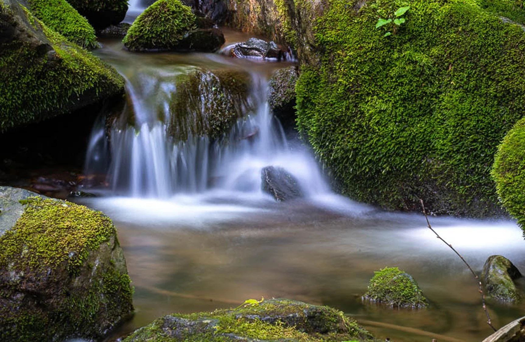
Located near milepost 22.1 along Skyline Drive, this 5.1-mile round-trip hike takes you through federally designated wilderness to a 93-foot waterfall tucked deep in the mountains.
But timing matters. Unless there’s been recent rain, the falls can be minimal or even dry—so planning your visit around conditions is key.
Trail Overview
Distance: 5.1 miles round trip
Difficulty: Moderately strenuous, rated as hard
Elevation Gain: 1,291 feet
Estimated Time: ~4 hours
Location: Milepost 22.1 (Mathews Arm Campground area)
This is a longer hike with steady elevation change, especially on the return.
How to Get to Overall Run Falls
Start at the Mathews Arm Campground Registration Parking Area at milepost 22.1.
From there:
Take Traces Trail
Continue onto the yellow-blazed Mathews Arm Road
Stay right at the intersection with Beecher Ridge Trail
Continue on Mathews Arm Trail
Turn left onto Tuscarora-Overall Run Trail
Follow it to a short side trail for upper falls views
Continue downhill to reach the main falls
The final stretch leads to the base of the tallest waterfall in the park.
What Makes Overall Run Falls Special
Overall Run Falls stands out for one reason:
It’s the highest waterfall in Shenandoah National Park
At 93 feet, it’s significantly taller than most other falls in the park.
But what really makes it unique:
Remote wilderness setting
Multi-tiered waterfall structure
Quiet, less crowded experience compared to popular falls
A true “earned” destination
This isn’t a quick roadside stop—you have to work for it.
Water Flow Conditions (Important)
This is one of the most important things to know before hiking.
Overall Run Falls is highly dependent on rainfall.
After rain → strong, flowing waterfall
Dry periods → minimal flow or nearly dry
If you’re planning this hike specifically for the waterfall, try to go after recent rain.

Best Time to Visit
After Rain (Best Overall)
This is when the falls are most impressive.
Spring
Best combination of water flow and scenery
Cooler temperatures for hiking
Fall
Great foliage
Water flow depends on rainfall
Summer
Can be dry
Hot conditions make the return hike more difficult
Photography Tips for Overall Run Falls
Use a Tripod for Water Motion
To get that smooth waterfall effect:
Use a tripod
Slow shutter speed
Shoot Multiple Angles
There are different viewpoints:
Upper falls (from side trail)
Main falls (lower section)
Watch Light Conditions
Waterfalls photograph best in:
Overcast conditions
Early morning light
Include Foreground Elements
Use rocks and surrounding terrain to add depth to your shots.
For a complete guide, see Photography in Shenandoah National Park
Trail Conditions & Difficulty
This is a moderately strenuous hike that is listed as hard.
Important things to know:
The hike is easier going down… harder coming back up
The return climb is steady and can be tiring
Terrain includes uneven and rocky sections
Wilderness Area Notes
This trail passes through a federally designated wilderness area.
That means:
Limited development
Natural conditions preserved
Some closures may exist to protect sensitive ecosystems
How Easy Is It to Access?
Parking at Mathews Arm Campground
Clearly marked trails
No technical climbing required
But:
This is a full hike, it’s not a quick stop.
How Much Time to Spend
Plan for:
~4 hours total hiking time
Additional time for photos and breaks
Nearby Stops and Connections
You can pair this hike with:
Other overlooks near mile 20–25
Skyline Drive scenic stops
A full day exploring Shenandoah National Park
Final Thoughts
Overall Run Falls is one of those hikes that feels like a real adventure.
It’s not the easiest waterfall to reach—but that’s part of what makes it special.
And when the water is flowing, standing at the base of the tallest waterfall in Shenandoah National Park makes every step worth it.
For a detailed trail map, elevation profile, and recent conditions, I recommend checking AllTrails before heading out.
Plan Your Visit
If you're exploring Skyline Drive as part of a larger trip, this overlook can be included in a full-day itinerary.
For a complete plan, see my guide to spending one day in Front Royal VA.
More from Scott Turnmeyer
I write about photography, business, mindset, bowling, and the bigger questions that don’t always have easy answers. You can explore more articles, photography, and projects here:
Blog Home
About Scott Turnmeyer
Fine Art Photography
Photography Workshops & Experiences
Digital Consulting