
Whiteoak Canyon Trail & Falls (Shenandoah National Park Upper Falls Hike Guide)
Whiteoak Canyon Trail is one of the most popular waterfall hikes in Shenandoah National Park—and for good reason.
Located at milepost 42.6 along Skyline Drive, this trail leads to a series of cascades and waterfalls, including a scenic overlook of the upper falls about 2.3 miles into the hike.
This route focuses on the upper section of Whiteoak Canyon, offering a rewarding hike with elevation, views, and multiple water features along the way.
Trail Overview
Distance: 4.6 miles round trip
Difficulty: Hard
Elevation Gain: 1,040 feet
Estimated Time: 3–4 hours
Location: Milepost 42.6 (Whiteoak Canyon parking area)
This is a steady hike with elevation change, especially noticeable on the return.
How to Get to Whiteoak Canyon Falls
Start at the Whiteoak Canyon parking area at milepost 42.6.
From there:
Take the Whiteoak Canyon Trail
Pass the junctions for:
Old Rag Fire Road
Limberlost Trail
Continue approximately 2.3 miles
Reach a rocky ledge with views of the upper falls
Retrace your steps to return
This route focuses on the upper falls and avoids the full lower canyon descent.
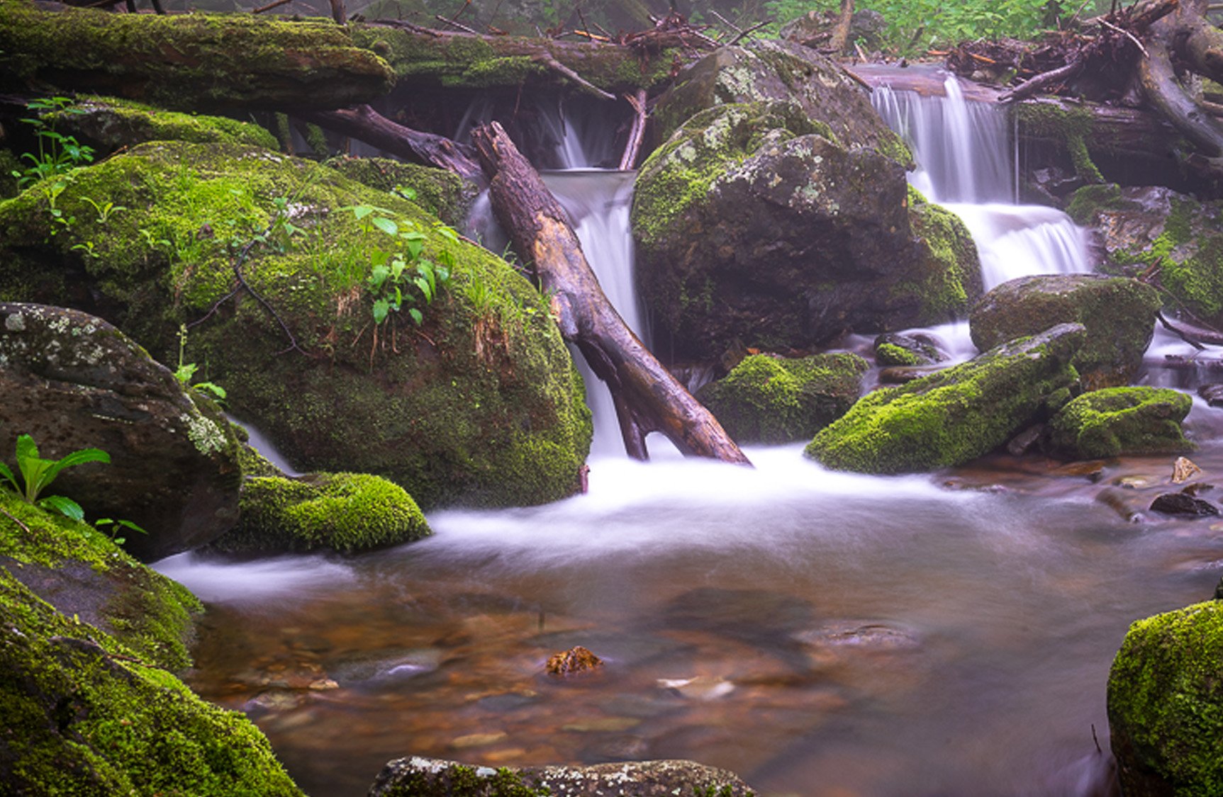
What Makes Whiteoak Canyon Special
Whiteoak Canyon is one of the most well-known waterfall systems in Shenandoah National Park.
What makes it stand out:
Multiple waterfalls and cascades along the trail
A mix of forest, rock, and water features
Scenic viewpoints along the way
A classic Shenandoah hiking experience
This is one of those hikes that delivers consistent interest—not just one destination at the end.
Water Flow Conditions (Important)
This is one of the most important things to know before hiking.
Overall Run Falls is highly dependent on rainfall.
After rain → strong, flowing waterfall
Dry periods → minimal flow or nearly dry
If you’re planning this hike specifically for the waterfall, try to go after recent rain.

Best Time to Visit
After Rain (Best Overall)
Water flow is strongest after rainfall, making the cascades and falls much more impressive.
Spring
Strong water flow
Cooler temperatures
Ideal hiking conditions
Fall
Beautiful foliage
Water flow depends on rainfall
Summer
Can be dry
Warmer conditions
Still a popular hike
Photography Tips for Whiteoak Canyon
Capture the Cascades Along the Way
Don’t wait for the final viewpoint—there are multiple photo opportunities throughout the hike.
Use a Tripod for Water Motion
To get that smooth waterfall effect:
Use a tripod
Slow shutter speed
Watch Your Composition
Use:
rocks
trees
water flow lines
to guide the viewer’s eye through your image. The rule of thirds will help here with compositions, especially on the smaller cascades.
Watch Light Conditions
Waterfalls photograph best in:
Overcast conditions
Early morning light
Include Foreground Elements
Use rocks and surrounding terrain to add depth to your shots.
For a complete guide, see Photography in Shenandoah National Park
Trail Conditions & Difficulty
This is a moderate hike with steady elevation change.
Important to know:
The return hike is uphill
Terrain includes rocky and uneven sections
Can be slippery near water
How Easy Is It to Access?
Parking at milepost 42.6
Well-marked trail
No technical climbing required
How Much Time to Spend
Plan for:
3–4 hours total
Additional time for photos
Nearby Stops and Connections
You can pair this hike with:
Skyland area stops
Other waterfalls in Shenandoah National Park
A full day exploring Skyline Drive
Final Thoughts
Whiteoak Canyon Trail is one of the classic waterfall hikes in Shenandoah National Park.
It offers a mix of scenery, elevation, and water features that make it a rewarding experience from start to finish.
And while the upper falls are a great destination, the real value of this hike is everything you see along the way.
For a detailed trail map, elevation profile, and recent conditions, I recommend checking AllTrails before heading out.
Plan Your Visit
If you're exploring Skyline Drive as part of a larger trip, this overlook can be included in a full-day itinerary.
For a complete plan, see my guide to spending one day in Front Royal VA.
More from Scott Turnmeyer
I write about photography, business, mindset, bowling, and the bigger questions that don’t always have easy answers. You can explore more articles, photography, and projects here:
Blog Home
About Scott Turnmeyer
Fine Art Photography
Photography Workshops & Experiences
Digital Consulting